
View all banners
FAFB will never call you and ask for your credit card details over the phone. If this happens, hang up!
Marine technology is a diverse industry and ranges from advanced navigational tools to safety devices and, for the commercial fishing sector, products designed to increase yields from target fish stocks, reduce bycatch and eliminate damage to gear.
Over the coming weeks, we’ll be covering some of the specifics of the technology behind these products in a series of articles plus looking at the Best Fishing Boat Technology for 2019.
However, in this feature, we take a specific look at Chart Plotters including some specifics about what they are for and the features they can offer plus a review of some of the more popular products on the market.
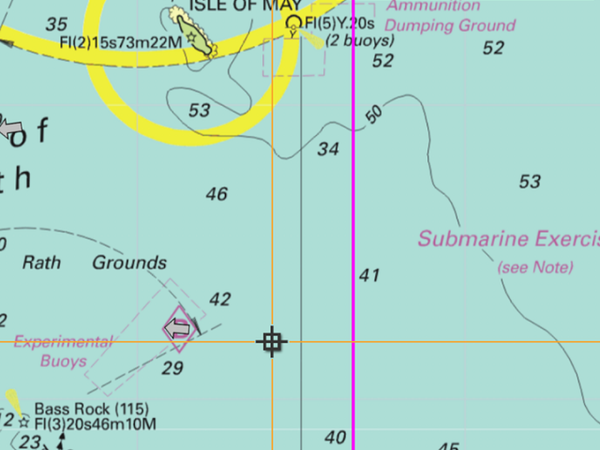
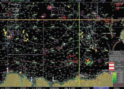
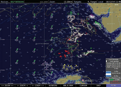
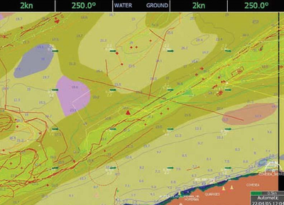
A chart plotter is an interactive, electronic version of a traditional admiralty marine chart which is used for navigation. This gives an accurate depiction of the ship’s position at any time and displays position, speed and heading. This can be used for safe passage planning as well as showing the contours of the seabed beneath the ship.
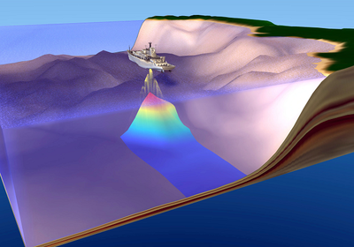
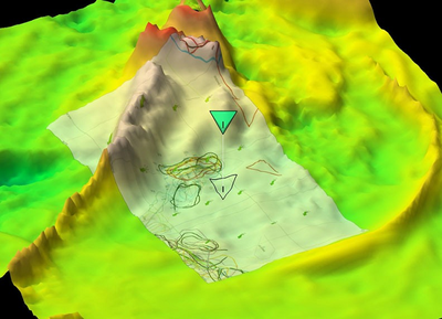
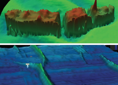
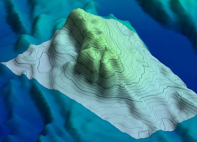
In addition, a chart plotter can be integrated with AIS, radar, echo sounder and all other ship’s sensor systems with current technology offering a full 3D display of the seabed at any point.
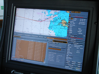
A marine GPS chart plotter receives information from the GPS antenna fitted to the ship. The signals from several satellites are correlated to achieve the best location accuracy. The current Latitude and Longitude is displayed on the chart plotter at any time as well as a dynamic icon of the current ships position.
3D Chart Plotters
A 3D Chart Plotter integrates the GPS location with information from Fishfinders, Sonars, and Echo Sounders and displays a detailed 3D image of the topography of the sea bed.
Depending on the type of chart plotter that you purchase, the returned information can be used to identify the following features, all via a single display:
Before you start shopping for a chart plotter, it is important to set your budget and to identify those features of this device that are most important to you.
With products available from as little as £400 ranging to several thousand pounds, there is lots to decide before you start shopping.
Display Screen With the main features of a chart plotter being to aid navigation, the first choice should be screen size and how the maps are installed. Are these dynamically updated and can they be linked with other navigational systems and tools or are they stand-alone? Is the screen size sufficiently large enough to allow you to accurately read the data show? Does it come with a backlight for use during low-light? Is it optimised for use in bright sunlight?
Portability Some chart plotters, just like a satnav in your car, can be removed and stowed securely or taken offboard for additional security. Other devices require that they are installed permanently in order to be fully integrated to your additional marine technology onboard. If portability between vessels is important then you will need to consider how easy these devices are to transport and install.
Integration If the additional features offered by a chart plotter are of interest, such as echo sounders/fish finders with 3D mapping or AIS tracking then you will need to consider the compatibility of the device with your existing onboard technology.
Speakers It is important for some skippers that the information relayed on a chart plotter comes with audible warnings as well as visual ones.
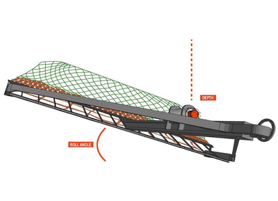
Gear Mapping With some chart plotters offering the additional benefits of visually mapping your trawl gear as well as tracking incoming biomass, this feature comes at a price but can deliver some exceptional benefits.
**Locations Covered ** Some products purchased in the UK will only come with charts and maps preloaded for waters around the mainland UK and Ireland with some coasts of Europe. If you are operating a vessel with a range outside of these areas then you will need to establish if the device can accommodate additional maps.
Application If you are a commercial fisherman and would like to benefit from the additional features offered by chart plotters which include sonar technology for fish finding then you will need to select a device which supports integration with echo sounding sensors or that has this function built-in.
The choice of chart plotters for the marine industry is a diverse one and offers a variety of products aimed at different users. From leisure cruisers and sports fishing to serious sail races and commercial fishing vessels. The differences between each of the products on offer are wide-ranging and prices will depend on what features you are buying.
We’ve selected two companies which offer a different selection of chart plotters aimed at two different markets.
With a background of over 35 years in the commercial fishing sector, [Seafield Navigation](http://seafieldnavigation.co.uk comes to the market with an incredible amount of experience. They offer a selection of solutions for chart plotters all aimed at this industry.
The charts produced are obtained using 3D mapping from IHO Standard Survey Data and with navigation plotters that provide accurate and reliable data using IMO approved Electronic Navigation Charts.
Based in Fraserburgh, they currently offer five navigation charts and 3D mapping solutions but, as a company, they pride themselves on their customer service and work with fishing fleet operators to produce suitable solutions for all project applications.
The Turbowin solution has been designed as a chart plotter for the fishing industry and offers simple and clear presentation of essential information. Reliable and accurate, the 2D imaging provides the user with data for fishing management as well as navigational information.
Optional upgrades allow the unit to support:
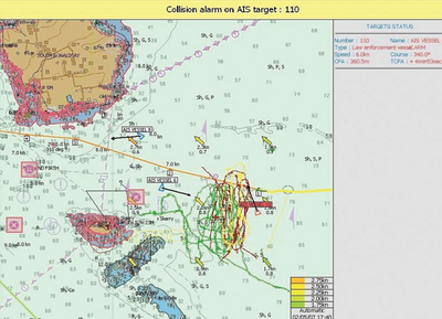
Designed for one-man vessels, the Solowin offers safety features such as collision alarms, anti-grounding warnings and ENC charts. As well as AIS tracking and tide height predictions, this is an ideal solution for smaller boats.
A stripped-down version of Turbowin, Easywin is available for skippers who may have a smaller budget than that of large commercial operators.
Offering similar features and the important information such as vessel speed, position and course, Easywin also offers:
The system can be fully optimised and modules may be added to the base spec to offer additional features such as:

Offering the same options as Turbowin and Easywin, Mini-ECDIS combines additional fishing management functions and official ENC charts& plotting. The solution has been designed very much with the commercial fishing sector in mind and meets the specifications of both MCA and Seafish for commercial vessels under 25m
Offering a dual screen mode that allows users to switch between a working view of marks, tracks and other data to a navigation mode, standard features include:
Uses official UKHO S57 Charts
Optional upgrades include wrecks database, trawl tracking, tidal stream prediction and 3D imaging with free depth database.
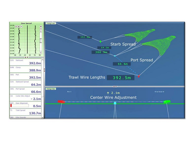
Notus has been designed very specifically for the commercial fishing industry and incorporates a headline NetSounder to allow you to accurately see what is going on beneath your vessel.
Sensors provide clear data that shows you the biomass entering the nets to detailed information on:
Offering '_ security through knowing not guessing_, Notus brings clarity to trawl fishing.
Gael Force Marine started trading in 1983 and has become one of the largest marine equipment supplies in the UK. They stock a wide range of aquaculture, commercial fishing and leisure boating products. Based in Inverness, there Marine Megastore incorporates over 7500 sq ft of showroom space displaying the latest marine technology and equipment.
They sell a selection of GPS chart plotters, all manufactured by Garmin ranging from entry level devices suitable for smaller scale fishing and leisure boating up to those that service more serious sport fishermen and sailors. They are not suited for commercial fishing and do lack some of the features offered by Seafield Navigation’s products.
An entry level chart plotter/fish finder that is easy to install and simple to use. The screen display is quite small at 4.3” but the Garmin is quite portable and comes with an a quick-release mount.
This device provides near photographic imaging of what is beneath the boat and is preloaded with BlueChart g2 charts for the UK and coasts of mainland Europe.
Sonar is provided by CHIRP ClearVu scanning and you can also easily share routes and waypoints using Striker or Echomap units.
This chart plotter is currently being sold for around £300.
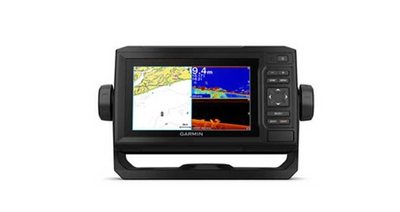
A similar spec to the above, the 65cv features a 6” screen and built-in WiFi so that you can pair the device with an ActiveCaptain unit and access additional charts.
The ActiveCaptain mobile app by Garmin is a useful tool that allows you to access your mobile calls, texts and other notifications from your mobile whilst it is stowed safely (and dry) on board. It also integrates with the QuickDraw contour mapping community.
Also featuring a quick-release mount, the unit is currently being retailed via Gaelforce Marine at a price of around £500.
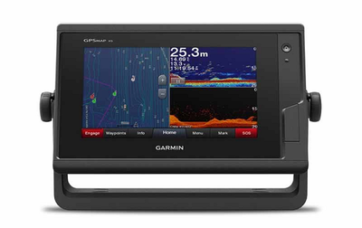
Two slightly more advance options are also available which feature similar specifications to the 65cv but come in a 7” or a 9” screen size. Prices for these two models range up to £850.
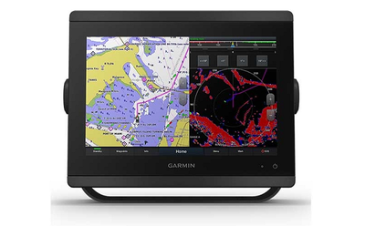
Featuring a 7” touch screen, this advanced navigation tool features full integration and network connectivity which is compatible with many sensors including:
There is also other wireless connectivity options such as ANT and built in Wi-Fi. This technology is priced at around £900.
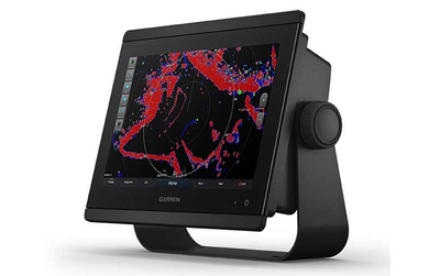
Both the 8410 and 8410x SV come with a 10” full HD touchscreen but come with a built-in sounder and can support audio alerts, AIS and is fully compatible with other Garmin software. The touchscreens can also be used as a monitor for Windows and Mac operating systems.
A more advanced option for serious sail racers, sports fishermen and cruisers, these devices are priced at £2,300 and £2,500 respectively.
As one of the UK’s largest classifieds site for fishing boats, we also offer a wide range of advertisements for marine equipment and services, including Marine Electronics. From VHF radios to echo sounders, plotters and sonar, you can find a great selection of new and used equipment via our listings.
