View all banners
FAFB will never call you and ask for your credit card details over the phone. If this happens, hang up!
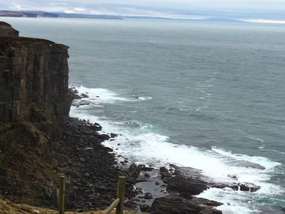
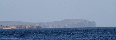
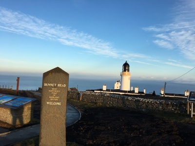
With some of the strongest tides and fastest currents in the world, the Pentland Firth is one of Britain’s most famous stretches of water. Though not actually a firth but rather a strait, the Pentland Firth separates the Northern most tip of mainland Great Britain from the Orkney Islands. It stretches at its southern tip from Dunnet Head and Duncansby (Caithness) to Old Head (South Ronaldsay) and Tor Ness (Hoy) in the Orkneys.
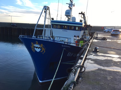
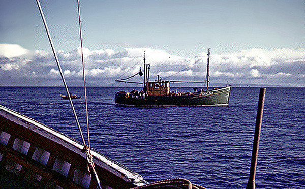
The firth is the home to several of Scotland’s important fishing harbours including Scrabster as well as historic ports like Thursom Wick and Skarksferry. It is, of course, the sea border to John O’Groats, the most northerly point of mainland Britain.
Roughly in the middle of the strait are two uninhabited islands, Stroma and Swona. Part of the Orkneys, these two small islands are the location of two important lighthouses to aid the safe passage and navigation of these dangerous waters.
Because of its prime location as a gateway to fishing in the North Sea and Atlantic Ocean from mainland Britain, the Pentand Firth is an important and strategic stretch of water. Due to the strength of the tides, the strait is also an important body of water for development as a source of renewable energy in the form of tidal power. Now the site of what will be one of the world’s largest tidal power farms, the first turbine of an ongoing project to provide power to 175,000 homes was unveiled in September 2016. The first 15 metre tall turbine, weighing 200 tonnes is now providing an output of 1.5 megawatts.
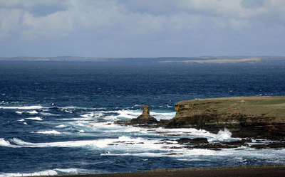
The area also supports a diverse and healthy population of marine wildlife and attracts seals (Grey Seal & Common Seal), porpoises, dolphins, whales (Minke and Orca) as well as basking sharks and leatherback turtles.
Though a small stretch of water, the Pentland Firth has had an influence on the culture and history of the British Isles with records of the strait being recorded in Norse sagas, accounts of the Roman empires attempts to subjugate the Orkney Islands as well as Scotland’s own folklore.
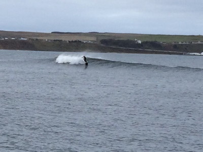
Twice a day, surges between the Atlantic Ocean and the North Sea race through the firth causing overfalls, tidal races, eddies and roosts. Most mariners the world over regard the Pentland Firth as a dangerous stretch of water and for centuries many a skipper would opt for a longer route around the Orkney Islands in the north of south via the English Channel to avoid it.
The force of the tide in parts of this stretch of water have been recorded at speeds of 30 km/h, or 16 knots, putting them amongst the world’s fastest tides.
The strait is renowned for its tidal waves, the most notable being:
The firth has plenty of other races all of which are capable of pushing even powerful vessels off course.
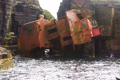
It is probably unsurprising that the list of casualties in the firth is a comprehensive one and includes both groundings and founderings a plenty. There are a number of wrecks mapped in the area particularly west of the island of Stroma.
Despite the inherent dangers of this characterful stretch of water, the firth is a busy shipping channel and accommodates over 6000 vessels each year of varying sizes and types.
Due to the tremendous threat that navigating the Pentland Firth posed, local fishermen (with their wealth of knowledge in the various characteristics of the strait) began serving as pilots to passing vessels in the 17th century. Keen to take the shortest route, skippers would signal for a pilot on the approach to the firth with pick up stops being situated around Freswick Bay and Noss Head (east) and Thurso (west). The fastest pilot to reach the vessel would get the job and, out of season, was good work for the fishermen. Usually, after safe passage, a vessel would drop the pilot on land where he would need to make his own way home or if his own vessel had been towed, he would simply navigate back to port.
There are some accounts of vessels that did not stop to return their pilots to shore and some made it as far as Ireland or The Faroes before they were allowed to make land. One such character, David Banks, made it as far as America before he tried to make his passage home via South America. After several years, during which time his family had given him up for dead, he finally made his return home to Scotland.
Pilotage peaked in the early Victorian age but had begun to decline by the turn of the 20th century as modern mapping and navigation improved. However, pilots are still used even today when large super vessels need to traverse the strait.

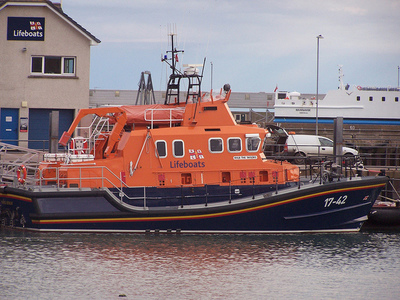
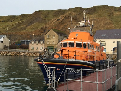
The RNLI has a long history of association with the firth and Thurso is, of course, home to mainland Scotland’s most northerly lifeboat station. The crew here regularly launch into the seas of the Pentland Firth and have been awarded over seventeen awards for gallantry as a result.
In the age of sail and before the days of modern mapping and weather forecasting, a single and unexpected gale could account for several vessels getting into trouble in these waters so lifeboats were situated in Longhope, Ackergill and Huna.
Distinctive in their lines and of Norse origin, the traditional fishing boats around the Pentland Firth are called Yawls (or yoles). With clinkered planking and pointed sterns and wide beam, the yowls are around 15-24’ in length. Though no longer built on a commercial scale, there are yowls still in use from some small fishing ports that are over a hundred years old.
Navigating the seas around the British Isles is made easier with the use of modern technology but there is never any substitute for understanding the unique characteristics of any given area. For more information, follow our series or get your copy of Reeds Nautical Almanac 2017: Available on Amazon.
And lastly, don’t forget to share this post on social media and leave us your feedback on other areas you’d like to see featured on Find a Fishing Boat